
Going up to Duck Pass, with a view of Barney Lake
Going up Duck Pass

I skipped Purple Lake and went on to Lake Virginia

I had the whole place to myself! Everyone stayed at Purple Lake. Lake Virginia was prettier and warm enough to swim. It has a shallow beach area where the water warms up.

This is when my tooth went bad.... In the morning it was throbbing so much that I decided that I should either turn back, or to go over the next pass and exit. My map showed that McGee was only a 13 mile trail to the trailhead, then 30 miles to Mammoth. What the map did not say is that this pass was actually 15 miles and very hard (not including the 2-3 miles to get to the trail fork from Lake Virginia). I lost the trail 2x and had to use my orienteering skills. McGee is not popular on its western side. It's eastern side is a popular fishing area. It was very easy to get lost between the PCT and the McGee Pass. I was a little scared. And there was not a single soul out there. And only two other sets of footprints.

After traveling up the McGee creek, and forging the creek at least 5x (soaked trail runner shoes), fending off mosquitoes, and tracking the true trail (versus false stream trails) I emerged in the High Sierra grasslands, with true trail.

And then hit the switchbacks on scree.


At the top of the pass I met two San Diego firefighters on a fishing trip. They hooked me up with Aleve and whiskey, and told me crazy stories of rescuing Navy guys. The guy in yellow's name is "Tractor" and the other guy did not have a trail name (and I forgot his real name). He dubbed me "Snaggletooth". I now have an official trail name. Snaggletooth. These guys were the best! (I accidentally saw them again in Mammoth at the Brewing Company. We three had lunch with "All Good" who is the head of http://www.allgoodsk9adventures.com/#!about_us/c14e3 )

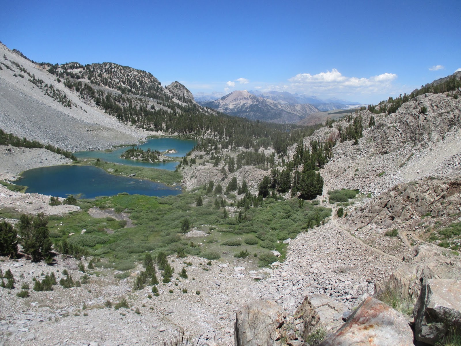
The McGee Pass travels between the Red Slate Mountain and the Red and White Mountain. Over 12,000 feet high. The pass is at 11,900. This is why the PCT and JMT hikers do not use it... The trail continues to follow down the McGee creek, and there are many lakes feed from its waters, including the Little McGee and the Big McGee. Many waterfalls and trout.
More about the McGee Pass: The area actually was the first Eastern Sierra ski area, before Mammoth. It was founded by the McGee family, who were Scottish limestone miners. Later, a guy named McCoy build a tow rope to get skiers up the mountain in the 1930's. (I did not take notes and cannot find the history via Google, so I am going by memory here.) Now, it is a fishing destination, next to the very large Lake Crowley.
The trail ends with a dirt path covered in Donkey's Ears and sage, and the heat of the other side of the High Sierra range. I was lucky that when I emptied out at the trailhead a local rancher and his son picked me up right away and drove me to Tom's Place. I got a bunk at Tom's Place for $30 a night, and medicated my throbbing tooth. The next morning I put the word out that I was hitching to Mammoth, and the owner of the local store drove me into town. He told me stories of Crowley Lake and recommended Convict Lake. We watched the hang gliders take off of the range I just traversed.

In Mammoth, I checked back into 19 Davidson, and the next morning took the YARTS bus back to Yosemite, where my brother and my car were waiting. We did get stuck in Yosemite two more nights due to floods. The highway to Merced washed out, so the traffic to the Bay Area was so backed up it made more sense to just make camp. We got the last campsite up by Glacier Point at Bridalveil Creek. It was a smart more. In the morning there was not a single car on the road. Now I am scheduled for a root canal!
No comments:
Post a Comment